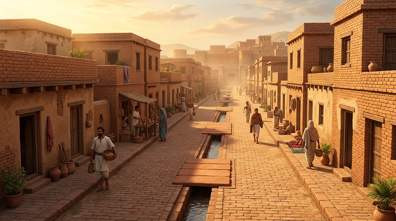
Over 4,500 years ago, while the builders of the Old Kingdom of Egypt were stacking monolithic limestone to raise the Great Pyramids, a drastically different, citizen-centric civilization was flourishing along the basins of the Indus and Ghaggar-Hakra rivers. The Indus Valley Civilization (Harappan Civilization), spanning present-day India, Pakistan, and Afghanistan, achieved levels of municipal sanitation, standardized civil engineering, and urban grid planning unmatched anywhere in the ancient world until the Roman Empire two millennia later.
The Chessboard Layout: Scientific Grid Planning
Unlike Mesopotamian and Egyptian cities, which grew organically and haphazardly around religious temples and royal palaces, Harappan cities like Mohenjo-daro, Harappa, Kalibangan, and Dholavira were planned on a strict geometric gridiron system:
- Cardinally Oriented Streets: Main arterial avenues, some measuring up to 9 to 10 meters wide, ran precisely North-South and East-West, cutting across one another at crisp 90-degree right angles.
- Town Bipartition: Cities were systematically divided into two distinct zones: an elevated, fortified Citadel (Upper Town) on the western side designed for administrative, civic, and religious assemblies (such as the Great Bath and the Great Granary), and an expansive Lower Town to the east containing residential neighborhoods and commercial workshops.
- Acoustic and Privacy Architecture: Residential house entrances opened onto quiet secondary lanes rather than noisy main avenues. Homes had blind exterior walls without street-level windows to prevent dust, optimize interior cooling, and preserve private family life.
World's First Underground Covered Drainage System
The crown jewel of Harappan civil engineering was its sanitary drainage network. Every individual household, whether modest or grand, featured a dedicated brick-paved bathroom and washing platform linked directly to municipal wastewater channels:
- Household Connection: Domestic wastewater flowed from bathrooms through ceramic clay pipes embedded in exterior walls into small street drain sumps (cesspools), where solid debris settled to prevent blockages.
- Underground Street Channels: The filtered water then poured into wide, mortar-sealed central drainage canals running parallel to the streets. These drains were constructed using kiln-fired bricks bonded with lime and gypsum mortar to ensure complete waterproofing.
- Inspection Manholes: Street drains were covered throughout by flat limestone slabs or baked terracotta tiles. Harappan sanitary workers routinely lifted these inspection slabs to clear out silt and sediment—an institutional public sanitation practice completely unprecedented in the Bronze Age.
Standardized Bricks and the Ratio of 4:2:1
Across an immense geographical territory exceeding one million square kilometers—from Manda in Jammu to Daimabad in Maharashtra, and from Sutkagen Dor in Balochistan to Alamgirpur in Uttar Pradesh—the Harappans manufactured standardized burnt bricks with an exact mathematical proportion:
Ratio of Length : Breadth : Thickness = 4 : 2 : 1
Whether measuring 28 × 14 × 7 cm for residential structures or 40 × 20 × 10 cm for monumental perimeter fortifications, this standardized ratio enabled the 'English Bond' bricklaying technique, which maximized seismic stability and wall structural integrity across millennia.
Hydraulic Marvels: The Water Reservoirs of Dholavira
At the island site of Dholavira in the arid Rann of Kutch (Gujarat), Harappan engineers constructed a breathtaking series of 16 interconnected, rock-cut rainwater harvesting reservoirs. By channeling seasonal runoff from the Manhar and Mansar rivulets through check-dams and inlet sluice channels into stone-cut cisterns holding hundreds of thousands of liters of potable water, Dholavira survived in one of the planet's harshest desert climates.
Competitive Exam & GK Takeaways
🎯 High-Yield Facts for UPSC, SSC & State PSC Exams
- Discovery: Harappa excavated in 1921 by Daya Ram Sahni; Mohenjo-daro discovered in 1922 by R.D. Banerjee under ASI Director-General Sir John Marshall.
- Standard Brick Ratio: 4 : 2 : 1 (Burnt bricks predominantly used in major settlements, exceptional for Bronze Age civilizations).
- Major Dockyard Site: Lothal (Gujarat), on the Bhogava river, featuring an artificial tidal basin for ocean trade with Mesopotamia (Dilmun/Meluhha).
- Dholavira Recognition: Declared a UNESCO World Heritage Site in 2021, celebrated for its unique tripartite city layout and rock-cut water reservoir system.
Legacy of Harappan Urban Planning
The Indus Valley Civilization proves that greatness in antiquity was not solely measured by tyrannical monuments or towering royal tombs, but by the dignity, sanitation, clean water, and civic infrastructure provided to ordinary citizens. Modern urban planners still study Harappan civil layouts to build resilient, sustainable smart cities today.



Comments & Reviews
Tap stars to rate this page: